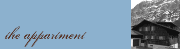
GPS: Lat: 46.625980 | Lng: 8.048966
Card point Swisstopo: 646757 / 164047
by car:
Drive through the village to the church (Talhausplatz)
After the church, turn to the right and immediately to the left into the Ischweg. The Ischweg is a banned road, but since you're coming to Chalet Firn, you're allowed to drive through.
The Chalet Firn is situated at the right side of the road near a road cross after about 200m.
distances:
from Berne (77km, ca. 1h 10min)
from Basel (166km, ca. 2h 05min)
from Lucerne (87km, ca. 1h 30min)
from Zurich (137km, ca. 2h 05min)
from Zurich Airport (153km, ca. 2h 15min)
by public transports:
regional train from Interlaken to Grindelwald (every half hour)
then townbus ('Ortsbus') or skibus to 'kirche' (church, 200m from the house)
travelling time:
from Zurich Airport: ca. 3h 20min (via Berne)
from Zurich: ca. 3h (via Berne)
from Berne: ca. 2h
from Basel: ca. 3h (via Bern)
from Lucerne: ca. 3h 15min (via Brünig)
Größere Kartenansicht